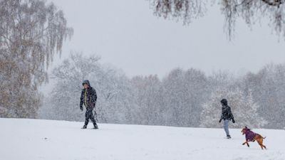
Britain set for snow as Met Office issues amber warnings - but where and when will it hit?

Most of England, Wales and Scotland are set for snow this weekend, as ITV's Good Morning Britain explains
The UK is in the grip of a wintry spell of weather, with the Met Office issuing two fresh amber warnings for snow and ice for parts of England and Wales over the weekend.
Temperatures fell into minus figures on Thursday night, with parts of Cheshire, Somerset and Dumfries and Galloway dropping to minus 5C.
Chilly conditions across the next few days could bring travel disruption and power cuts, with forecasters warning parts of England could see as much as 40cm of snow.
Weather warnings for snow and ice are already in place for some parts of the UK, with more set to come into force at the weekend.
But where will be worst hit, and when can we expect the snow to arrive?
When will snow arrive, and where?
The majority of England and Wales will see snow on Saturday afternoon.
From midday on Saturday until midnight on Sunday, a yellow weather warning for snow and ice will come into force, covering most of England and Wales.
An amber warning for snow and freezing rain covering most of Wales and central England will then be in place from 6pm on Saturday to midday on Sunday, the Met Office said.
A second amber warning for snow, covering most of northern England, has been issued from 9pm on Saturday to midnight on Sunday.
Most of Scotland is under a yellow weather warning for snow at midnight on Sunday, lasting until midday on Monday.
Yellow weather warnings for ice have already been in place overnight, lasting until 10am on Friday morning, and covering Wales' west coast, parts of Northern Ireland, West Yorkshire, and most of Scotland.
How much snow will fall?
About 5cm of snow is expected widely across the Midlands, Wales and northern England.
Some 20-30cm could fall over high ground in Wales, and potentially 30-40 cm over parts of the Pennines, which could bring power cuts.
Which areas will be the coldest over the weekend?
The lowest temperatures are expected in rural Scotland, where temperatures could plummet to as low as -10C on Friday evening.
Will anywhere avoid the snow?
Parts of England's coastline are not covered by the weekend's weather warnings for snow and ice, including Cornwall, Exeter, Portsmouth and Brighton.
Coastal areas across Norfolk and Suffolk are also not affected, as well as coastal parts of the Humber, Newcastle and Northumberland.
How will it affect travel?
The Met Office has warned people to be prepared and aware when travelling, with longer journey times likely.
Railways are likely to experience delays or cancellations, with National Rail confirming that various routes across England, Scotland and Wales are impacted.
Subscribe free to our weekly newsletter for exclusive and original coverage from ITV News. Direct to your inbox every Friday morning.
Why is there a UKHSA health warning?
The UK Health Security Agency (UKHSA) has issued an amber cold weather alert from 12pm on Thursday until January 8.
UKHSA's weather alert system provides an early warning to the health and social care sector and government departments in circumstances where temperatures are likely to impact the population's health.
The agency has put the warning in place as it believes the cold snap will bring a likely rise in deaths among those over the age of 65 and those suffering from health conditions.
How long will the cold snap last?
The Met Office have said conditions should become warmer by the end of this weekend, before cold weather strikes again early next week.
Meteorologist Dan Stroud said: “The second half of the weekend should be in the high singles or low doubles. But temperatures will dive again next week, particularly on Monday and Tuesday.
“They should start to improve towards the latter end of the week. But there’s a lot of water to go under the bridge until then.”
What advice has the NHS given?
NHS Black Country in the West Midlands has warned people to wear shoes with good grip, and avoid setting out early when frost is thick or going outside in the dark.
Other NHS trusts across the country have encouraged people to check in on older people and their neighbours, and to stock up on food and medicines.
How can drivers stay safe?
Driving in icy conditions can be risky - and there are certain things to avoid if you're planning to get behind the wheel in snowy weather.
Firstly, consider whether travelling is absolutely essential. The easiest way for motorists to stay safe in the snow is to stay at home.
If you can't avoid driving, make sure your windscreen is fully defrosted. Driving when it is half cleared restricts your vision, and risks a fine for dangerous driving.
Make sure you haven't left snow on the roof of your car when driving, as slabs of compacted snow and ice could become a hazard or damage cars travelling behind.
Avoid using boiling water or wipers to defrost your windscreen. Wipers can freeze solid, so attempting to use them can cause expensive damage, while boiling water can crack a windscreen.
Want a quick and expert briefing on the biggest news stories? Listen to our latest podcasts to find out What You Need To Know